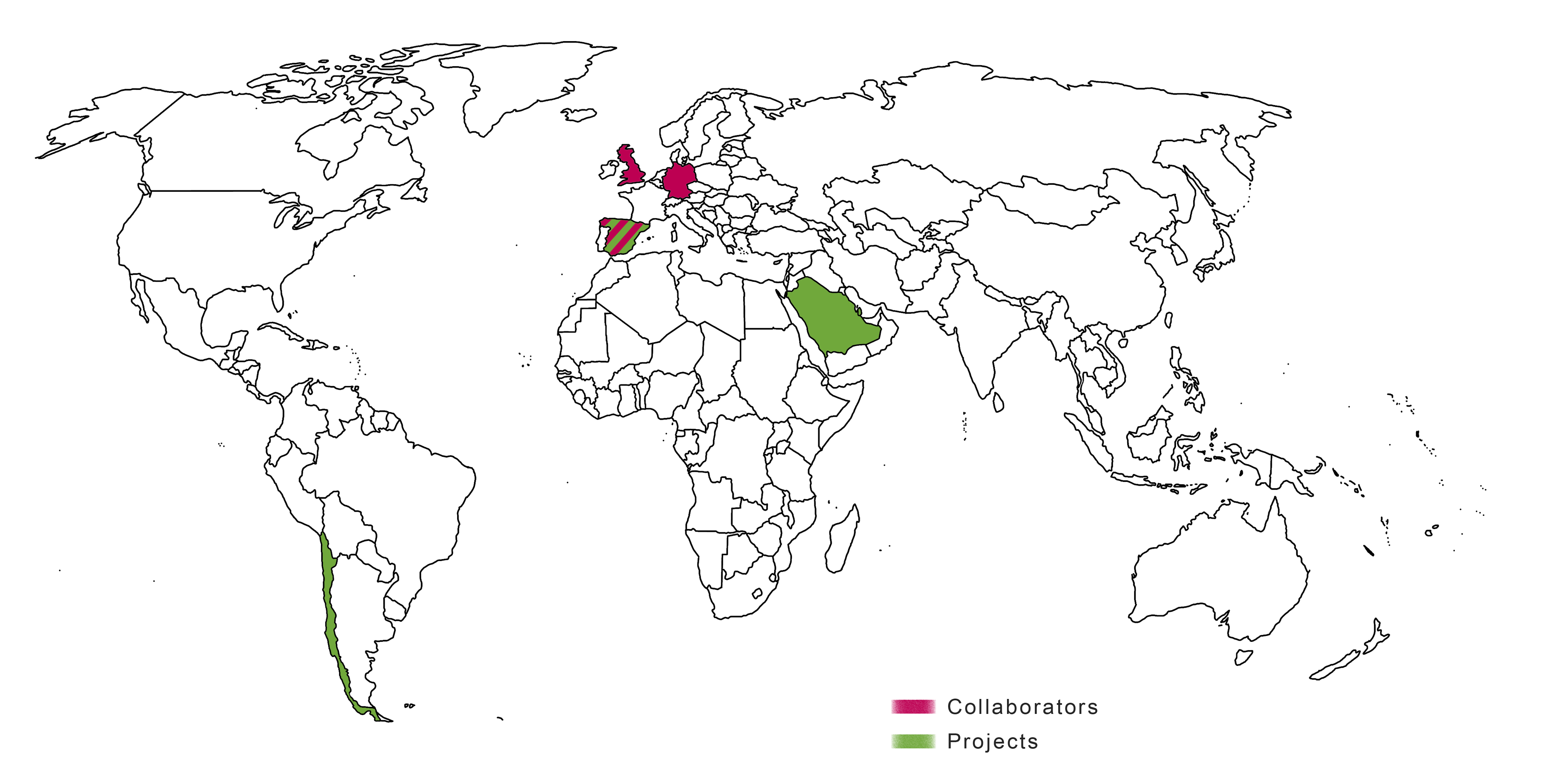
Projects
Some of our main projects are briefly summarized in these pages.
PUBLIC CONTRACT
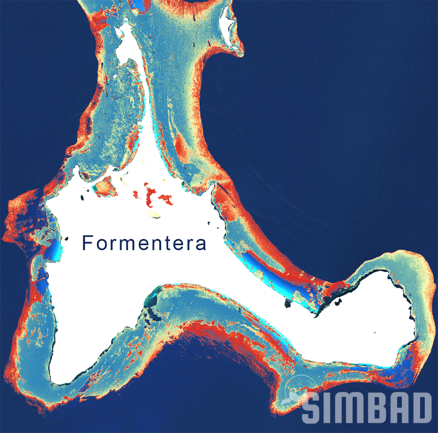
Service for the Improvement of Cartographic Information on the Distribution of Posidonia Oceanica
Using information from Sentinel-2 and AI, Quasar is developing PO maps along the entire Mediterranean coast of Spain for the Spanish Ministerio para la Transición Ecológica y el Reto Demográfico. The initial project successfully finished in December 2022 and is expected to continue in the future for the provision of improvements and updated seasonal maps.
INDUSTRIAL CONTRACT
Identifying Water Pipe Leaks using SAR Data from Sentinel-1
Quasar is developing an automatic detection water leak system using a combination of Sentinel-1 SAR data and our Soil Moisture algorithm to be applied to the detection of underground pipe breakage. The developed system implements a method to calculate not only the soil moisture in a particular area, but also, the accumulated (summed) moisture. This indicator could prove to be more sensitive than the derived single point soil moisture on a given date. The produced maps show big promise in the location for known leaks.
R+D PROJECT + INDUSTRIAL DOCTORATE
Coastal Water Quality: Fecal Bacteria
Water quality is a general descriptor of water properties in terms of physical, chemical, thermal, and/or biological characteristics. The quality of water is affected by materials delivered to a water body from either point or non-point sources. Monitoring and assessing the surface water quality are very important for managing and improving its quality. Remote sensing tools provide spatial and temporal views of water quality parameters at the surface of the water body that are not readily available from in situ measurements. It is an efficient tool to map and monitor different water quality parameters, i.e., chlorophyll, suspended sediments (turbidity), colour dissolved organic matter, temperature etc.
The major water quality parameters are suspended sediments, turbidity, algae, organic and inorganic chemicals, thermal releases, aquatic vascular plants, pathogens, and oils. Among them, suspended sediments, turbidity, algae, dissolved organic matter, oils, aquatic vascular plants and thermal releases change the energy spectra of reflected solar radiation or emitting thermal radiation from surface waters that can be measured using remote sensing techniques. On the other hand, most chemicals and pathogens do not directly affect or change the spectral or thermal properties of surface waters, so they can only be inferred indirectly from measurements of other water quality parameters affected by these chemicals. E. coli are rod-shaped, gram-negative facultative anaerobic bacilli which are preferred indicator of faecal contamination in various water types. Enterococci are a subgroup within the faecal streptococcus group which have the ability to survive in salt water. Literature showed that these faecal bacteria is influenced by turbidity, PH, salinity and temperature. It was also proved that there is a positive correlation of the concentration of faecal bacteria with temperature and precipitation. Quasar is working on a pilot project with a townhall in Mallorca to detect and monitor faecal bacteria coming from sewer spillages that could affect the quality of bathing water in the beaches.
Quasar is working on a pilot project with a townhall in Mallorca to detect and monitor faecal bacteria coming from sewer spillages that could affect the quality of bathing water in the beaches.

INDUSTRIAL DOCTORATE
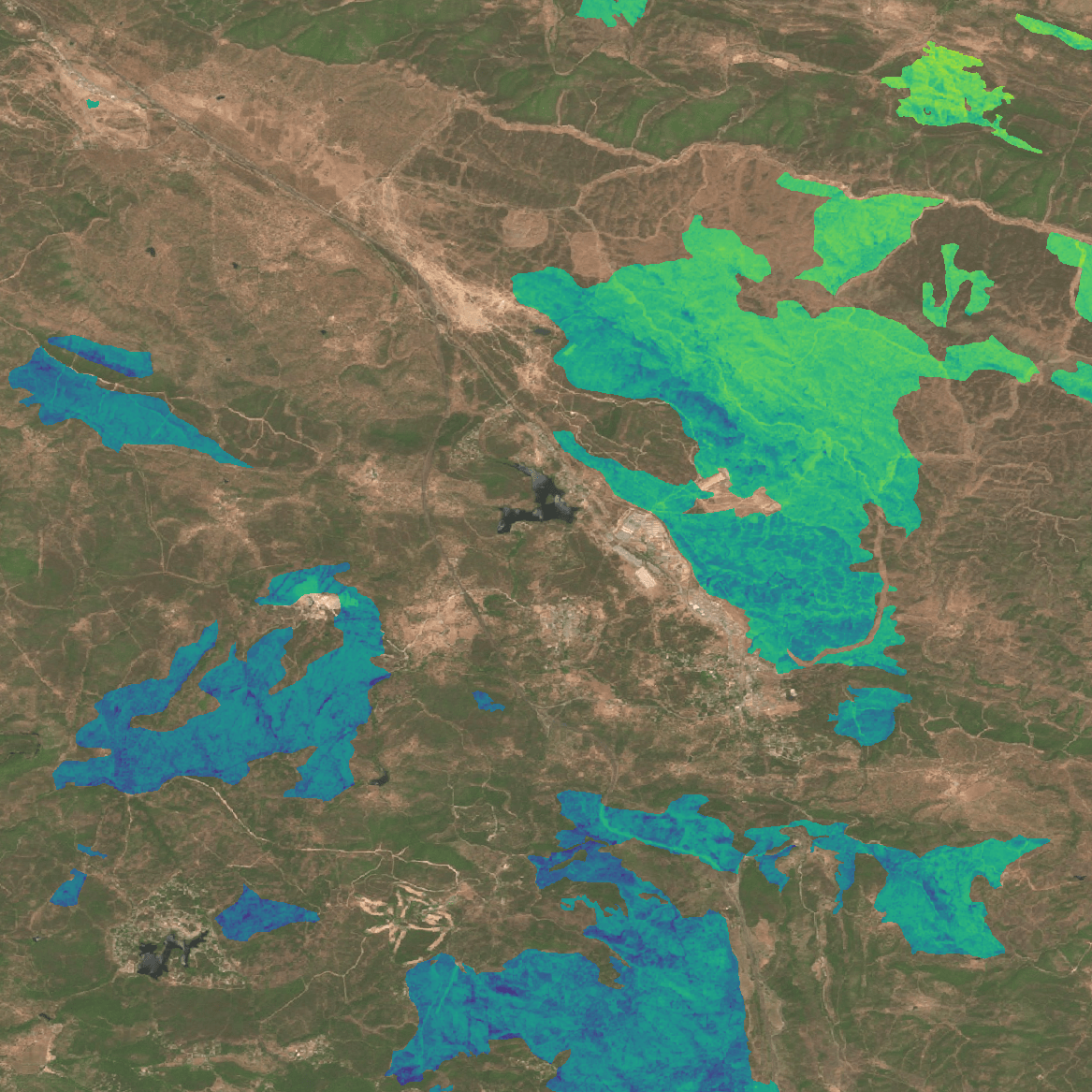
Enhancing Wildfire Risk Management Through Remote Sensing Techniques
The critical role of Live Fuel Moisture Content (LFMC) in influencing wildfire behaviour, occurrences, and the extent of areas burned is well-documented, yet its integration into wildfire risk indices is still in its infancy. When combined with on-the-ground measurements, vegetation indices obtained from Sentinel-2 satellite imagery can offer a reliable estimate and forecast of LFMC levels. Furthermore, incorporating microwave backscatter data from Sentinel-1 satellites could enrich this predictive capability.
Through the application of empirical models alongside machine learning algorithms, this research develops accurate LFMC cartography. Such advancements hold significant promise for land management professionals and the strategic planning of prescribed burns, offering a novel tool in the fight against wildfires.
PRIVATE CONTRACT
Boat and Oil
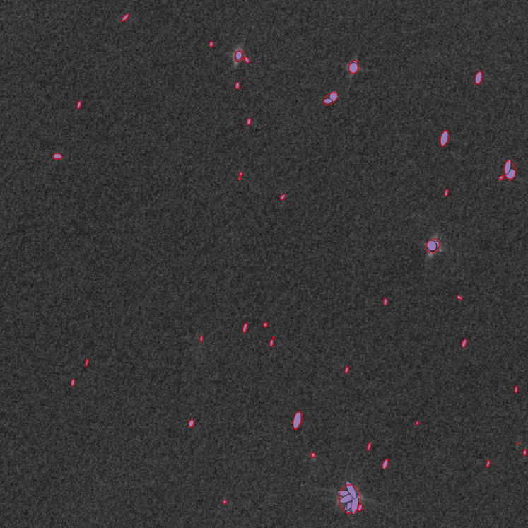
Platform Identification in Brasil Oil Field using SAR Sentinel-1 images
Sentinel-1 provides global, regular and repeated coverage of coastal and open sea waters. With its Synthetic Aperture Radar (SAR), Sentinel-1 has the advantage of operating under cloud cover or a lack of illumination and can acquire data over a site during day or night time under all weather conditions. One of the many applications of Sentinel-1 SAR data is for Maritime Monitoring, making it suitable for vessel detection.
By monitoring ship behavior, it is possible to alert of potential illegal activities, like border crossings, infringements of maritime traffic separation schemes, and illegal fishing. Maritime surveillance is also useful to assess the use and management of the maritime space.
Sentinel-1 routinely collects large amounts of images which are made freely available. The vast amounts of data produced by the constellation of satellites are a great opportunity to develop systems for Maritime Monitoring. To become fully operational, these processing systems must be entirely automatic with a controlled level of reliability and robustness.
The system developed by Quasar provides a fully automatic ship detection algorithm for Sentinel-1 SAR images, providing long-term, wide-area monitoring of vessel traffic along with vessel location and size estimators and classification. Automatic vessel detection, without human intervention, requires reliable results in order to remove false alarms which are not due to vessels. As an example of system performnce, for boats larger than 30 meters in length, the success rate is more than 80%, a fairly good value according to other studies.
Projects by Geographical Representation
Promoting Young Researchers at SIMBAD
Remote sensing time series and prediction dynamical models for the evaluation of agricultural systems.
Industrial Doctorate Programme of the Comunidad de Madrid (IND2020/AMB-17747) in collaboration with the Universidad Politécnica de Madrid.
Development of algorithms to characterize the quality of coastal waters using Sentinel data.
Industrial doctorate programme from the Ministerio de Ciencia e Innovación Español (DIN2020-010979/AEI/10.13039/501100011033) in collaboration with Cádiz University.
Development of forest wildfire risk maps in real time using remote sensing techniques for the Comunidad de Madrid.
Industrial Doctorate Programme of the Comunidad de Madrid (IND2022/BIO-23597) in collaboration with the CSIC-INIA.